Best World Map for Toddlers to Spark Early Geography Learning
Introducing a curated collection of kid-friendly world maps and map-inspired learning tools designed to engage toddlers and early learners. This guide focuses on durable, visually appealing options that simplify geography concepts—continents, oceans, landmarks, and national symbols—through bright colors, tactile pieces, and interactive features. Each pick supports classroom readiness, homeschooling, and home play, helping children develop curiosity and foundational geographic knowledge at an age when hands-on exploration matters most.
| Product | Brand | Highlights |
|---|---|---|
| Momo & Nashi United States Map For Kids & World Maps For Kids 2pc Set | Momo & Nashi | Two posters, updated content, vibrant visuals |
| BEST LEARNING i-Poster My World | BEST LEARNING | Interactive learning with voice guidance |
| 2 Pack – World & USA Map for Kids [Illustrated] – 2 Poster Set | Palace Learning | Two laminated posters, durable for classrooms |
| World Map Banner Playroom Decor | XFN | Large fabric banner, bright colors, versatile decor |
| Rand McNally Kids’ Illustrated World Wall Map | Rand McNally | Color-coded continents, landmarks, durable paper |
Momo & Nashi 2-Piece World Map Set

The Momo & Nashi two-poster set pairs a United States map with a world map, designed for wall display in classrooms, bedrooms, and homeschool spaces. The posters feature updated content, kid-friendly icons, and landmark illustrations that encourage dialogue about regions, cultures, and geography. The visuals use bright colors and clear typography to support early readers and visual learners, making it easier for toddlers to spot familiar places while expanding their geographic vocabulary.
BEST LEARNING i-Poster My World
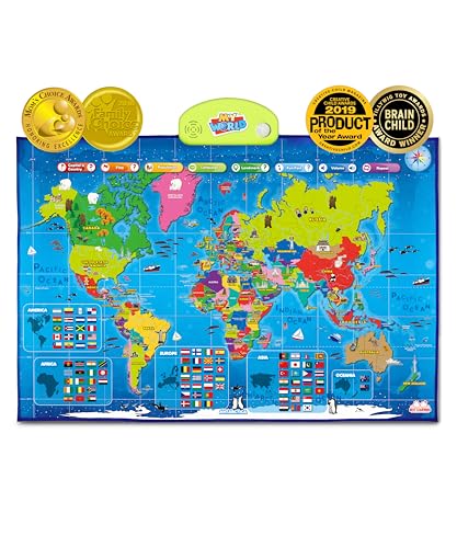
This interactive world map engages children with more than 500 voice-guided questions, helping to reinforce country names, capitals, oceans, continents, and flags. An award-winning educational toy, it supports STEM-minded exploration and global curiosity. The listening feature fosters independent learning and can be used for guided activities, storytelling, and conversational prompts about different cultures and environments.
2 Pack World & USA Map for Kids (Illustrated) Lavished Posters

This laminated two-poster set provides durable wall maps measuring 18″ by 29″, featuring illustrated continents and country imagery. The laminated coating resists tears and stains, making these posters suitable for busy playrooms, classrooms, and learning corners. The visual diversity helps children distinguish continents and national symbols while practicing reading skills and map orientation.
World Map Banner Playroom Decor
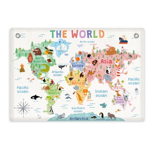
This large linen banner features bright colors and concise typography, designed to capture a toddler’s attention and complement various interior decors. The 28.5-by-20-inch banner is versatile for playrooms, classrooms, nurseries, and reading corners. Its soft material and clean visuals help young learners identify continents and major regions in a non-overstimulating way.
Rand McNally Kids’ Illustrated World Wall Map

Rand McNally’s illustrated world map features color-coded continents, vibrant illustrations of flora, fauna, landmarks, and cultural icons. It includes labeled capitals and major cities, serving as a reference map for early learners. Printed on durable paper, it’s well-suited for wall displays in classrooms or homes, providing a visually engaging overview of global geography.
Buying Guide
When selecting a world map product for toddlers, consider these factors:
- Durability: Look for laminated posters, fabric banners, or wood-based puzzles that withstand active play and repeated handling.
- Age appropriateness: Choose visuals and interactivity suited to toddlers and early elementary learners, with clear fonts and simple icons.
- Interactivity: Interactive options, such as audio prompts or tactile pieces, can deepen engagement and memory retention.
- Space and placement: Assess the display area; larger banners work well in playrooms, while posters fit classrooms and study corners.
- Educational balance: Ensure content covers continents, oceans, capitals, landmarks, and cultural icons without overwhelming detail.
- Durability vs. portability: Poster sets are easy to rotate, whereas durable puzzles and banners stay in place longer.
Perspective considerations:
- Classroom-focused: Laminated posters and durable banners minimize wear from daily use and classrooms’ high traffic.
- Home education: Interactive maps encourage parent-guided exploration and storytelling about different regions and cultures.
- Visual learners: Bright colors, clear typography, and iconic imagery support recognition and memory in toddlers.
- Multi-sensory learning: Combining posters with tactile puzzles or felt maps engages multiple senses and supports motor development.
Overall, the chosen options provide a spectrum of formats—from interactive devices to sturdy physical maps—designed to cultivate early geographic awareness while fitting various spaces and learning styles. Selecting a mix of visuals, durability, and interactivity helps ensure toddlers develop curiosity about the world in an age-appropriate, engaging manner.